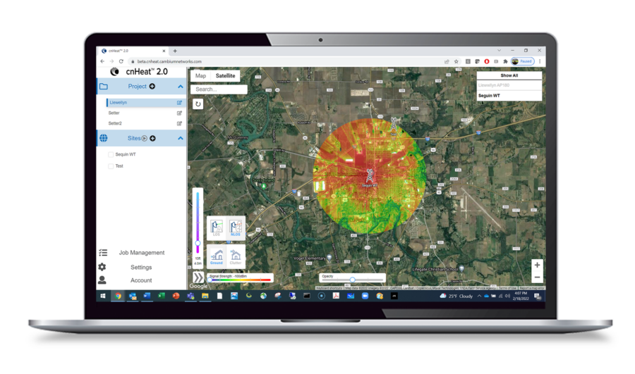
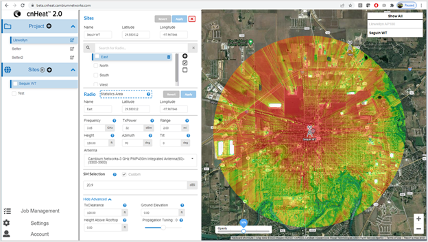
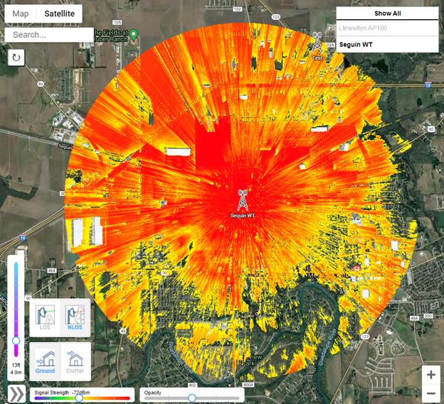
Built upon Cambium Networks’ expertise in fixed wireless modeling and integrated with one-meter resolution GIS data, cnHeat allows the user to generate highly accurate wireless predictions that accurately represent real world results.
Prequalification
Planning
TowerEval sites provide a cost-effective way for operators to run quick test predictions to see the potential coverage of a new tower. A summary of all covered buildings is automatically provided as an email attachment for each submitted job.
TowerEval sites run in about one-tenth the time of a standard cnHeat prediction and can be ordered as either fixed or moveable sites.
Marketing
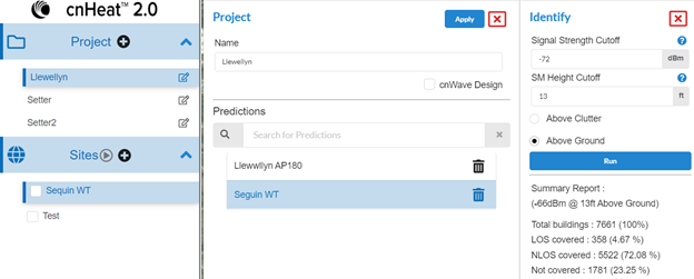
For each prediction cnHeat automatically searches for coverage of each building around the tower site. Operators can specify a minimum signal strength and installation height. A summary of covered buildings is provided, and if the operator desires, they can purchase the lat/lon of each covered building.
Additionally, the cnHeat map can be embedded in the operator’s website to have potential customers check for coverage and have their contact information forwarded as sales leads.
Reporting
A special export function allows operators to export their coverage in the format required by the FCC for filing BDC availability data. Data can be filed either via polygon method or location method.
Experience cnHeat – Request Service
Try it out for yourself! Provide your contact information, and a representative will reach out to setup a single tower trial site of cnHeat.
“Our 1,200 subscribers cover one county completely and a quarter of the surrounding counties. There was no way I would have been able to go through and look at all these addresses. cnHeat makes it easy with a very minimal amount of work.”
– Kurt Fankhauser, President, Wavelinc Communications
Read the case study:
Avoid Government-Funded Overbuilds Using cnHeat with Integrated BDC to Submit High-Quality Data.
cnHeat makes it easy for broadband service providers to efficiently plan reliable service and meet FCC reporting and NTIA BEAD funding requirements with Broadband Data Collection (BDC) capabilities.
Webinar: Avoid Overbuilds by Adding CBRS to Your Towers and Use cnHeat BDC
Watch the webinar replay
Video: cnHeat Works with Any Manufacturer’s Equipment
Video: How Accurate is cnHeat?
Video: Demystifying the BEAD Program for WISPs
Video: cnHeat Tower Eval
Introduction Video
BEAD Program Funding Resources
Explore available funding, technology solutions and real world service provider experiences to plan your strategy.
Resources
Documentation
- Precision Connectivity: Crowsnest Broadband’s cnHeat Success
- Simplifying the BDC Reporting Process with the Precision of cnHeat
- Avoid Government-Funded Overbuilds Using cnHeat with Integrated BDC to Submit High-Quality Data
- Hiawatha Broadband Communications Discovers New Connections With cnHeat
- Redfox Uses cnHeat to Add up to 30 Customers per Month
- Skynet Maximizes Their Workday with cnHeat
- Show Up, Get It Done, Leave: Connecting the Unconnected with cnHeat Heat Maps
 cnHeat Works with Any Equipment
 Broadband Data Collection (BDC) and cnHeat Podcast
 Demystifying the BEAD Program for WISPs
 Enhance Customer Satisfaction with Fixed Wireless Solutions
 cnHeat Extends Heat Maps to Non Line of Sight and Near Line of Sight Environments
 cnHeat Customer Experience: Enhanced 3 GHz nLOS/NLOS Support
 cnWave: Delivering Gbps Services with Distributed Mesh Networking
 cnHeat 3GHz nLOS / NLOS Propagation Model (Short Version)
 cnHeat 3GHz nLOS / NLOS Propagation Model
 cnHeat Field Experiences with Skynet WISP
 Introducing cnHeat
- Webinar Replay: Automate Your Workflow with the New cnHeat API
- Webinar Replay: Optimize Your Network with cnHeat’s New Tower Eval Feature
- Top Ten Reasons WISPs Love Working with Cambium Networks
- Making BDC Reporting EASY
- Top 10 Reasons to Switch to Cambium Networks
- Avoid Overbuilds by Adding CBRS to your Towers and use cnHeat™ BDC (Broadband Data Collection)
- 3 GHz PMP 450: Take Advantage of Cleaner Spectrum, More Power, and Serve NLOS